
United States
-
2022
Project Year
-
€5-10 M
per Project
-
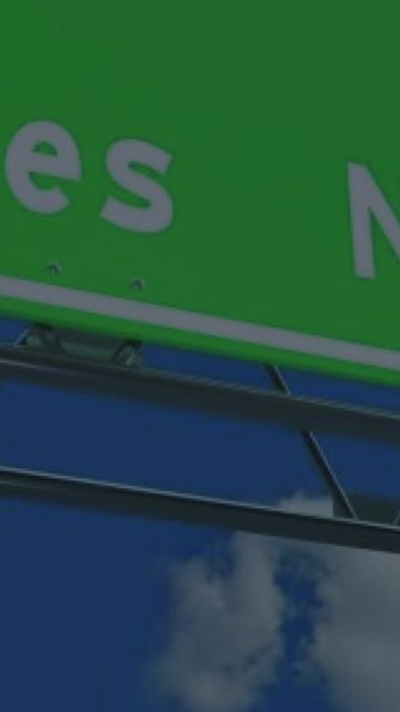
22miles
Sensored Highway
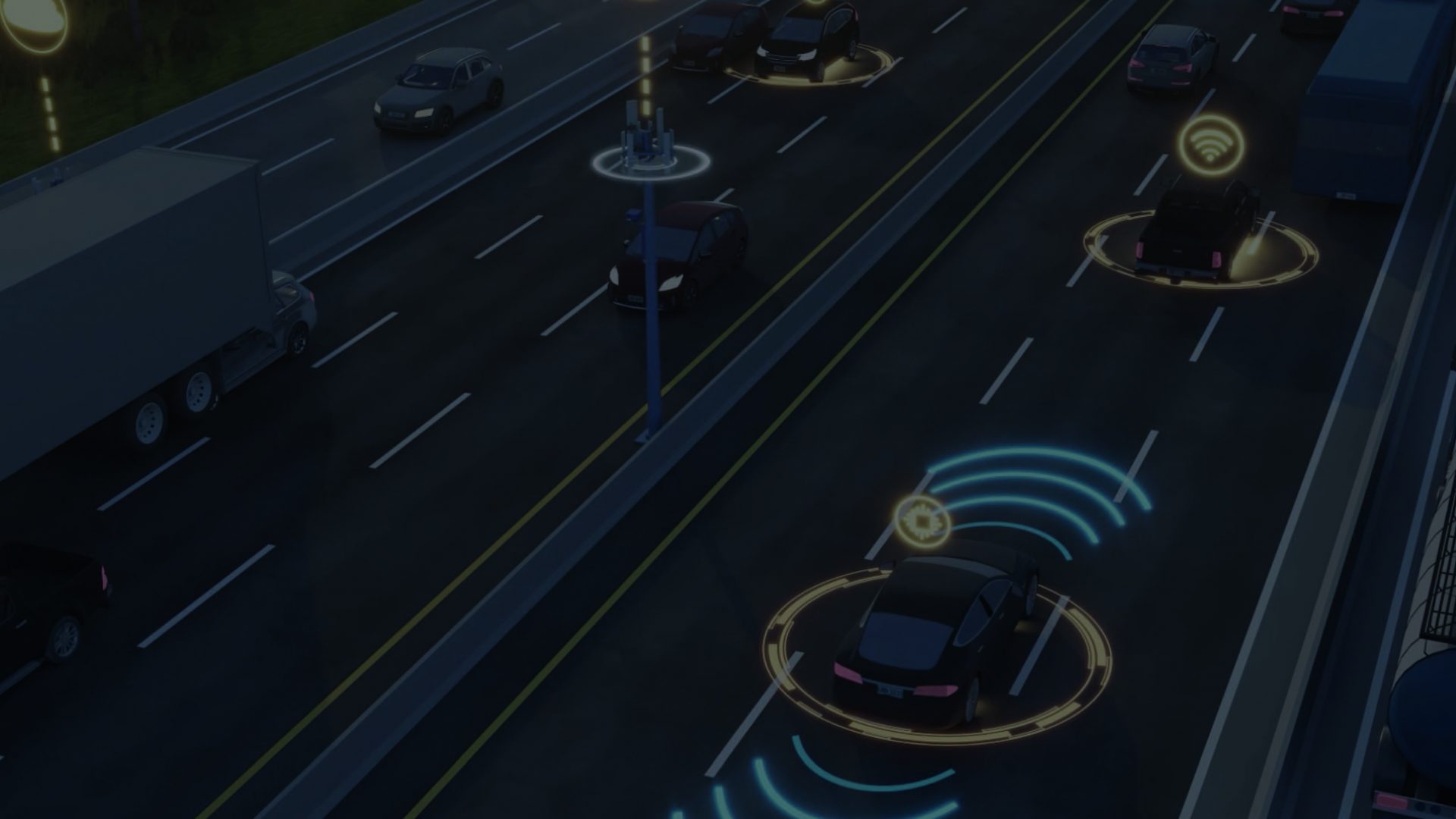
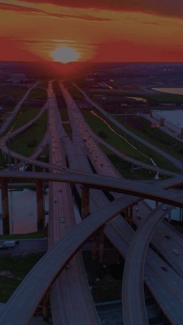
AIVIA’s main goal is to set the standard for the infrastructure and technology of the future in which conventional, connected and autonomous vehicles can co-exist harmoniously and that the maximum benefits of those technologies can be leveraged to maximize safety and traffic flow on our highways.
The initiative is presently testing new ways to build and implement the physical and digital infrastructure needed for the highways of the future – making the most of innovations such as Cellular Vehicle-to-Everything (CV2X), 5G, simulation technologies, advanced supervision and sensory technology to make roads more resilient.
AIVIA is aligned with Ferrovial’s Horizon-24 Plan, which aims to develop sustainable infrastructure with projects of high concession value, with North America being the key market for growth and development. The short term goal, partially achieved in 2023, was to apply all tested technologies on the I-66 corridor in Virginia to launch the first connected highway that shares safety information with vehicles and drivers real-time, with other assets following thereafter.
AIVIA is an initiative as a joint endeavour with global innovators
Testing Technologies and Providers
Cintra’s most prominent assets – North Tarrant Express Highway in Dallas and 407 ETR at Great Toronto Area, are the test beds for AIVIA to test new physical and digital solutions with our partners (3M, Kapsch , Microsoft, Telefónica and CapGemini). We are presently testing various technologies and providers under real traffic conditions to ensure a best-in-class efficiency of infrastructure, sensing devices and monitoring systems.
- In partnership with 3M, our teams are refurbishing segments of the road with a range of materials and solutions including retroreflective tape marking – four to five times brighter than now and visible in all driving conditions, which will become crucial to guarantee safe operation of autonomous vehicles under all conditions.
- As per the sensing hardware, we’re deploying new intelligent equipment such as lidar, radar and machine vision solutions to detect everything that happens on the road. The newer technologies like radar and lidar come to help, and complement the gaps that cameras can’t cover.
- However, the best sensors of the future will be the cars themselves. The Internet of Things (IoT) is a must to extend our digital fingers to all corners of the road. Indeed, the capacity of self-powered & self-connected sensors and actuators will support the digitization of our Highways and is key for controlling some very local events like car breakdowns, hits on the barriers or ice on the road.
- New communications systems will be deployed and will become part of the standard designs of new highways. New radio units will be installed to receive information and status from vehicles and also to broadcast electronic safety messages to connected vehicles (C-V2X) in real time.
- Dynamic messaging signals displaying accurate information for drivers to be aware of any risk event downstream will be placed along the Highway for conventional vehicles turning our corridors into true – digital highways.
Many technologies are getting stressed under real traffic conditions, with the ultimate objective for AIVIA to select only the more reliable and scalable, which will finally integrate with the core of the system: the software platform that orchestrates all vehicles by sharing the right information at the right moment with the right actors.
How Does AIVIA Bring Value?
The AIVIA initiative is helping to maximize the utility that CAVs and other cutting edge technologies can bring while providing benefits for all road users of today. AIVIA aims to define the blueprint of the sustainable infrastructure of the future for mixed traffic, using cutting edge technology to make travel safer, journey times more reliable and adding value to highway users through enhanced connectivity and the services that come with it.
Related Projects
See more projects
66 Express Outside the Beltway, VA
North Tarrant Express, TX
407 ETR
Behavioral Economics
Real-Time Propensity Factor
Augmented Reality (AR)
Global
-
2020
Project Date
-
4
Technologies Tested
-
7
3D Models Used
Augmented Reality (AR) is the technology that supports the overlay of digital information on real-world elements. Augmented reality keeps the real world central but enhances it with digital information, such as equipment data or 3D models.
We have been exploring the use cases and benefits of using Augmented Reality (AR) technology, including the Microsoft HoloLens 2. A Proof of Concept (PoC) was performed using HoloLens 2 to carry out remote site tours.
Identified Cases for the Use of AR Technology
- Remote site visits, connecting remote sites to managers and directors
- Remote assistance to technicians on site
- Overlay of 3D models on site facilitating project coordination and progress reviews with clients and subcontractors
- Visualize underground utilities to avoid any risks during excavation process
- Taking measures of project features and progress
- Safety training and introductions
- Visualize asset operational data overlaid in reality and fill in information checklists
In the PoC carried out in November 2020, the following use cases were successfully tested:
Remote Site Tours
A Virtual tour was carried out where the executive committee was able to perform a virtual visit to the Citrus project, a building construction project in Pozuelo de Alarcón Madrid. The tour was carried out using the Trimble XR10 hardware (HoloLens 2 version for Construction) on site and the application of Microsoft Remote Assist in the HoloLens, which is directly connected to Microsoft Teams.
This use case is driven by the COVID-19 global situation and what used to be a frequent process of directors visiting our sites to undertake site tours, has proven very challenging in the last year with the restriction on contact and travel. While technology currently cannot fully replace this face to face experience, this project has proven that the use the HoloLens technology has the potential to at least partially replace the capability to connect and collaborate with our assets and contracts.
Overlay of 3D models in reality
Project 3D models where overlaid into the reality using Trimble Connect application for HoloLens 2 and shared virtually with the remote assistants of the virtual tour. Visualizing the 3D models in a real-world scale can support the early identification of errors and support decision making.
The lessons learned from this PoC include:
- Technology easily usable by a range of personnel without specific technical skills
- Good audio capabilities of the technology to be used on construction sites (noise cancelling)
- Great capabilities of technology to overlay 3D models on site shows significant potential for driving multiple use cases
- Overlay of 3D models in reality only takes a couple of minutes
- Need of 4G and/or WIFI connectivity on site to enable the use of this technology
Related Projects
See More Projects
Heathrow Airport
407 ETR